Mapping a Path Forward
from hackster.io
Large buildings often have very complex floor plans that make them difficult to navigate for those unfamiliar with the space. Traditional 2D maps can quickly become a tangled mess in these types of locations, which makes it nearly impossible to quickly understand the layout of an unfamiliar area.
This creates a problem for first responders in emergency situations where every second is of critical importance.
As an alternative to traditional 2D maps, 3D maps can offer a great deal more clarity, which aids in rapidly gaining an understanding of indoor spaces. Methods commonly used to create 3D maps require a lot of hands-on work, and many hours of scanning to create, however.The time and cost associated with this process prevents many buildings from being mapped in 3D, and even in cases where 3D maps are generated, they may grow outdated because of a reluctance to remap areas after construction or other layout changes.
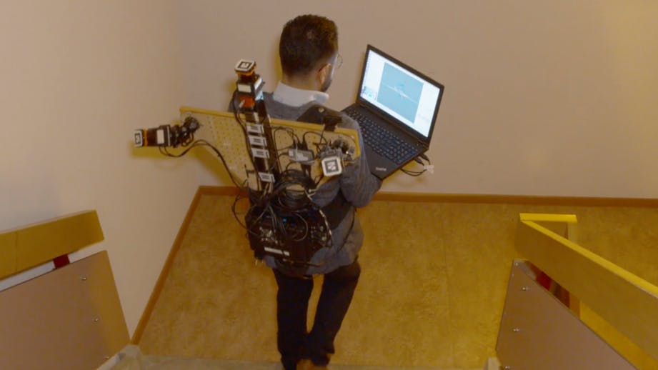
A PhD candidate at the University of Twente built an end-to-end solution that helps alleviate many of the difficulties associated with the 3D mapping of indoor spaces. The hardware has been built into a backpack, and all that one needs to do to create a map is go for a stroll about the building.
The backpack contains three 2D light detection and ranging (LiDAR) scanners and an inertial measurement unit (IMU). As the wearer walks about the space, the LiDAR scanners record points all around the walls, doors, and other structures of the building.Since GPS is not available indoors, the IMU sensor keeps an eye on accelerations and angular velocities of the backpack, and these measurements are fed into a custom algorithm to determine localization information.
The localization method is not as accurate as GPS, so a correction algorithm was employed that recognizes areas that have been previously visited to allow the system to correct for inappropriate measurement drifts that occur over time.With this error correcting system in place, the device was tested in a number of large buildings where it was proven to produce accurate 3D maps quickly. With a bit further refinement to make the device more user friendly, it may provide the information needed to help first responders more quickly respond to indoor emergencies in the future.


Leave a comment